The Pacific Southwest Research Station
and the Centro de Investigación Científica y de Educación
Superior de Ensenada (CICESE), a Mexican Federal institute for
science and education in Baja California, are cooperating in scientific
studies of fire and forest conservation that mutually affect the
Californias.
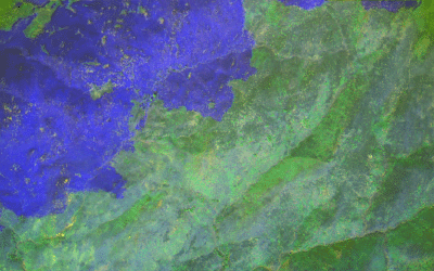
PSW is providing remote sensing annually over the Sierra San
Pedro Mártir, which supports Mexico’s only Californian
mixed-conifer forest. Wildland fires have never been effectively
suppressed there, and the range has not been subject to timber
harvesting or management; thus, it provides a scientific control
for fire suppression and forest use north of the border. Imagery
is being collected and analyzed to discern rates of drought and
pathogen-related forest mortality, to determine the importance
of small, lightning-ignited fires in the natural fire regime,
and to determine the large-scale consequence of fire on forest
structure. Future studies will include monitoring of the behavior
of active wildfires in the range.
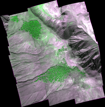
PSW has also provided a baseline of remote sensing data for
coastal estuaries in Baja, which respond to fire-related sedimentation
in the backcountry, and for Guadalupe Island, which is home to
threatened populations of Guadalupe Cypress and Monterey Pine.
Imagery are aiding in conservation of these species and their
genetic material, and in efforts to eliminate non-native grazers
and restore the island’s terrestrial ecosystem.


