|
|
|
Vegetation mortality
survey,
San Bernardino National Forest
27-30 April 2003
As viewed by the FireMapper™
system
in reflected red, near-IR, and thermal IR frequencies
Images were collected
from the PSW Airborne Sciences Aircraft flying over the
area near Big Bear Lake.
|
|
|
The forests in the San Bernardino Mountains and the
Peninsular Ranges are seriously drought stressed. In addition,
some have diseases (dwarf mistletoe, annosus root disease)
which also cause severe stress. Stressed trees can't produce
enough resin to protect against pathogens. Examples of these
include the California flatheaded borer, mountain pine beetle,
red turpentine beetle, Jeffrey-pine beetle and western pine
bark beetle. The fir engraver attacks fir trees while the
Ips beetle is a scavenger that attacks the tops of trees,
along with slash and seriously distressed trees.
Trees in the San Bernardinos are subject to drought, air
pollution, and complexes of pests, not just beetles. Deciduous
species are affected the same as the coniferous species;
black oaks there are suffering from drought stress and also
defoliation by the fruit-tree leafroller.
(Entomologist Dr. Laura Merrill, personal
communication)
|
| |
|
|
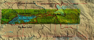
Location Map:
Shaded relief map of the Fawnskin, Big Bear City,
Rattlesnake Canyon, Big Bear City, Moonridge, and Onyx Peak
area. Color overlays show area of processed imagery.
|
Click on the image above to view a larger JPEG image
|
| |
|
|
Image 1:
Image showing small patches of stressed and dying trees.
(From an area just south of Big Bear City.)
|
|
| |
Healthy vegetation is bright green; stressed or dying
vegetation is yellow-brown in this false-color depiction.
(This RGB image shows reflected red light at 650 nm in
red, reflected NIR at 850 nm in green, and thermal IR at
10.5 um in blue.)
|
| |
|
| |
|
|
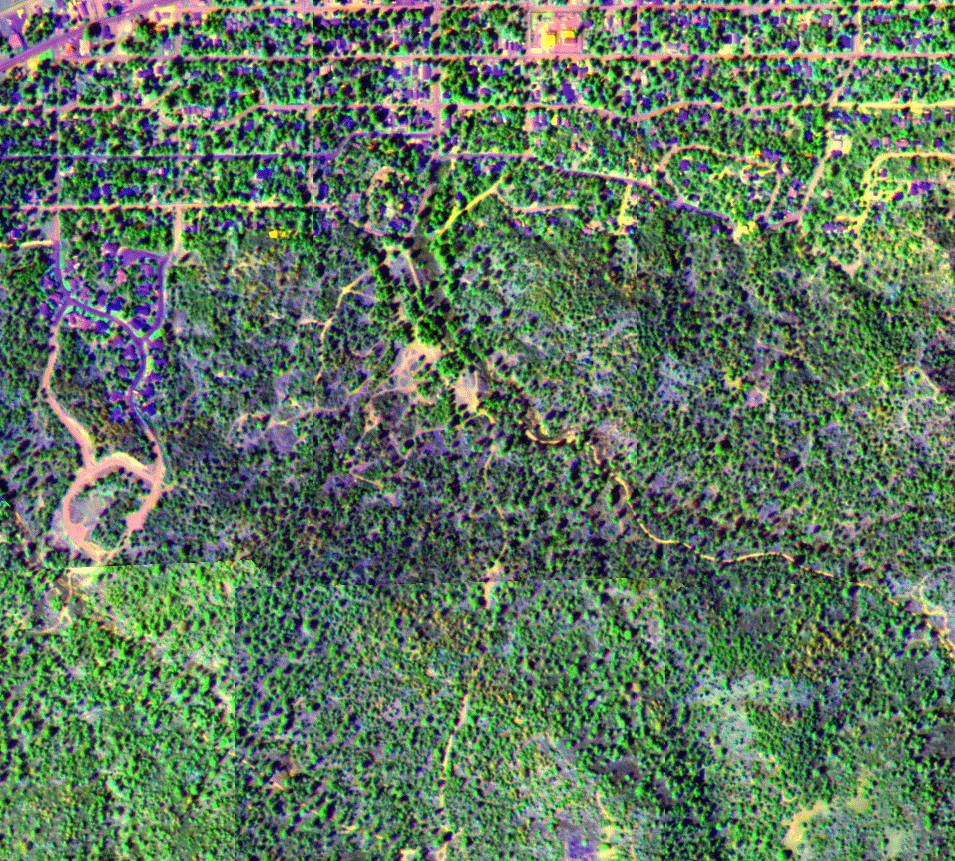
Image 2:
A mosaic of images from a flight 4-27-2003. Big Bear
City is in the center of the image.
|

Click on the image above to view a zoom to full-resolution image
in a new browser window
|
| |
Healthy vegetation is bright green; stressed
or dying vegetation is yellow-brown in this false-color
depiction. Bare ground is yellow.
Residual patches of snow (on north-facing
slopes) are bright yellow.
(This RGB image shows reflected red light
at 650 nm in red, reflected NIR at 850 nm in green, and
thermal IR at 10.5 um in blue.)
|
| |
|
|
Image 3:
A portion of the image mosaic from a flight 4-30-2003.
Seven Oaks is in the center of the image.
|
|
| |
Healthy vegetation is bright green; stressed or dying
vegetation is yellow-brown in this false-color depiction.
(This RGB image shows reflected red light at 650 nm in
red, reflected NIR at 850 nm in green, and thermal IR at
10.5 um in blue.)
|
| |
|
|
Image 4:
A mosaic of images from a flight 4-30-2003.
|

Click on the image above to view a full resolution image in a new browser
window
|
| |
Healthy vegetation is bright green; stressed
or dying vegetation is yellow-brown in this false-color
depiction.
Residual patches of snow (on north-facing
slopes) are bright white.
(This RGB image shows reflected red light
at 650 nm in red, reflected NIR at 850 nm in green, and
thermal IR at 10.5 um in blue.)
|