|
|
 |
San Dimas Experimental Forest
| |
|
SDEF Home Page | Williams Fire | Fire Severity | Fire Emissions | Water Quality | Water Yield | Ecology | Lysimeters | Resources & Maps | Photos | Management Plan | Site description, Facilities, and Use | The Future of San Dimas
Monitoring Plan |
 |
|
San Dimas Experimental Forest
April 6, 1999
DRAFT
|
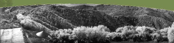
| The San Dimas Experimental Forest (SDEF) is managed by the Forest Service Pacific Southwest Research Station as a field laboratory for ecosystem studies in chaparral and related Mediterranean-climate ecosystems. From its establishment in 1933, the SDEF has been a center for hydrologic research in mountain watersheds. This research included intensive monitoring of precipitation and water yield and studies that manipulated the natural vegetation to maximize water yield with a minimum of soil erosion. More recently research has emphasized the impact of wildland fire on watershed processes and air quality, the effects of chronic air pollution on stream-water quality and the biogeochemistry of nitrogen, processes and rates of soil development and erosion, patterns in plant community development, and remote sensing of fire and ecosystem process. Research at the SDEF has developed an extensive database on mountain hydrology and climate. The SDEF has been designated as a Biosphere Reserve by the U.S. Man and the Biosphere Program. It contains the Fern Canyon Research Natural Area, part of the Forest Service national reserve system.
Environmental monitoring at the SDEF currently includes collection of climate data, multi-spectral airborne remote sensing, measurement of stream flow and stream-water nitrate concentration and yield, and observation of long-term trends in populations of Neotropical birds.
Ecosystem monitoring at the SDEF is coordinated by the SDEF Forest Manager.
SDEF Monitoring includes the following elements: |
| Element: |
Objective: |
Approach: |
Climate and weather |
Provide basis for hydrologic analysis at hourly to daily (or other) scales. |
Precipitation is measured by recording gauges at Tanbark Flats, Bell Canyon gauging station, and 3 other sites; air temperature, RH, wind velocity and direction, & solar radiation are measured at Tanbark Flats. |
Stream water yield |
Determine inter-annual variation in stream response from chaparral and degraded watersheds. |
Recording Flumes and V-notch weirs are operated at watersheds 801, 802, 803, & 804 in Bell Canyon and at Volfe Canyon. |
Stream-water nitrate concentration and discharge |
Determine long-term trends in nitrate yield from chaparral watersheds subject to chronic air pollution; assess effects of vegetation age and development on nitrate yield. |
Nitrate concentration is monitored in watersheds 803 and 804 with rates varying from 4 samples per day during storm flow to 2 samples per week during spring base flow. |
Remote sensing |
Provide multispectral data to characterize long-term vegetation change. |
Annual coverage is provided with a multi-spectral visible, short-wave-infrared, and thermal-infrared imager and other high resolution digital photography as available. Minimum resolution of 2 to 5 meters is provided over Bell and Fern canyons. |
Avian populations |
Determine long-term trends in avian diversity in ecosystem with very low direct human disturbance |
Three transects are monitored in Fern Canyon RNA and other oak woodland, conifer, and chaparral habitats in the SDEF. |
Soil erosion |
Monitor long-term sediment yield from undisturbed watersheds |
Sediment accumulation is measured in four Bell Canyon debris basins after significant, annual-scale events. |
Vegetation biomass |
Determine long-term trends in biomass accumulation |
Basal area and biomass are estimated at 3 to 5 year intervals on long-term real-growth plots in Ceanothus crassifolius chaparral. |
|
|
|
|
|