|
>500 C
300 C
200 C
100 C
65 C
<64 C
|
 |
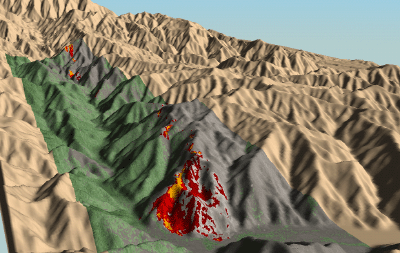
Williams Fire, Angeles
National Forest
25 September 2002
As viewed by the FireMapper™
Thermal-Imaging Radiometer
Images were collected from the PSW Airborne
Sciences Aircraft and disseminated in part by satellite
communications in near-real time. FireMapper measures the
radiance of emitted thermal-infrared light, which readily
penetrates smoke. False-color images shown here depict the
apparent surface temperature (in Celsius) as estimated from
radiance and a simple black-body model. Warmer tones represent
recent or active combustion; areas of gray are cooling ash
or warm bare ground. Low temperatures of unburned forest
and cool ground are shown in green. Images have been geographically
referenced. Vertical exaggeration in 3-D views is 1.5 to
one unless otherwise noted.
|
| |
|
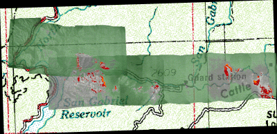
| Location Map |
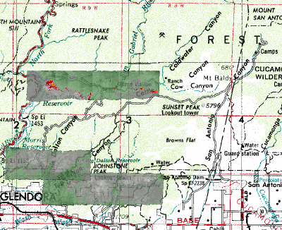
Click on the image above to view a larger JPEG image |
| |
|
|
Image 1:
Ground surface temperatures as viewed from above at 11.5 to
12.3 micrometers wavelength on 25 September 2002, between
11:41 and 11:44 pm.
|
Click on the image above to view a larger JPEG image |
|
|
|
| |
|
|
|
|
|
Image 2:
Ground surface temperatures as viewed from above at 11.5 to
12.3 micrometers wavelength on 25 September 2002, between
11:49 and 11:54 am.
|
Click on the image above to view a larger JPEG image |
|
|
|
| |
|
| |
|
|
Image 3:
Ground surface temperatures as viewed from above at 11.5 to
12.3 micrometers wavelength on 25 September 2002, between
1:13 and 1:16 pm.
|
Click on the image above to view a larger JPEG image |
| |
|
|
Image 3a:
Topographic view from the Northwest of Image 3, above.
|
Click on the image above to view a larger JPEG image |
| |
|
|
Image 4:
Ground surface temperatures as viewed from above at 11.5 to
12.3 micrometers wavelength on 25 September 2002, between
4:24 and 4:40 pm.
|
Click on the image above to view a larger JPEG image |
| |
|
| |
|
|
|
|
| |
Download the data from the passes at full resolution,
in native ERDAS Imagine .img format zip files from our ftp
site!
(Teale Albers projection)
|
| |
Pass 05 Image 1 |
| |
Pass 07 Image 2 |
| |
Pass 25 Image 3 |
| |
|
| |
Pass 31 Image 4 |
| |
Pass 28 Image 5 |
|
|
Download the data from the passes at full resolution,
in geo-coded tif format zip files from our ftp site!
(Teale Albers projection)
|
| |
Pass 05 Image 1 |
| |
Pass 07 Image 2 |
| |
Pass 25 Image 3 |
| |
|
| |
Pass 31 Image 4 |
| |
Pass 28 Image 5 |
After downloading a TIFF as a zip file, decompress it with WinZip
(or your favorite ZIP utility) and the TIFF will be viewable in
WangIMG or other graphics viewer. Included are the auxiliary files
necessary for proper geo-referencing (if the viewer has that capability).


