|
|
|
 |
Fire Science: Wildfire Monitoring and Prediction
|
|
Fire Imaging: Flick Creek Fire |
|
|
|
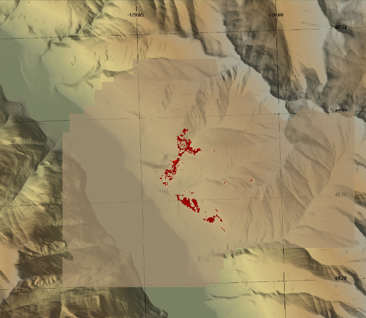
Flick Creek Fire, Okanogan and Wenatchee NF, WA
8 September 2006
As viewed by the FireMapper™ 2 Thermal-Imaging Radiometer
-data collected by the Bureau of Land Management aircraft N30W-
|
|
Click on the image above to view a larger Zoomify(JPEG) image
(opens a new browser window)
Current Image: Thermal mosaic
Ground surface temperatures as viewed from above at 8-12 micrometers wavelength on 8 September 2006, between 18:57 and 18:58 PDT.
|
| |
|
Image 1: Thermal Mosaic
Plan view of fire. Warmer tones represent recent or active combustion; areas of light gray are cooling ash or warm bare ground and the low temperatures of unburned forest and cool ground are shown in darker gray (see chart above).
|

Click on the image above to view a larger JPEG image
(opens a new browser window) |
|
|
|
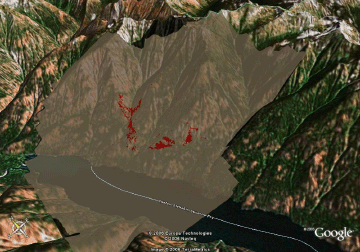
Image 2: Mosaic Overlay
Topographic view from southwest.
No vertical exaggeration.

View this image of the Flick Creek Fire as a Google Earth overlay.
|
Click on the image above to view a larger JPEG image
(opens a new browser window) |
|
| |
FireMapper™ has
been developed through a Research Joint Venture with Space Instruments,
Inc., and support from the National Fire Plan, Forest Service International
Programs, the U.S. Department of Agriculture, the Joint Fire Sciences Program, and the U.S. Agency
for International Development.
|