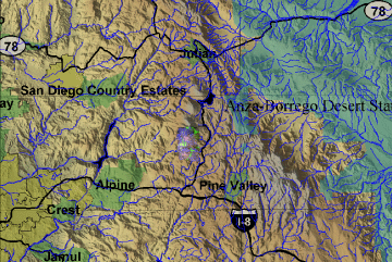
Post-fire Mapping
Cedar Fire, western Cuyamaca
Rancho State Park
5 November 2003
As viewed by the FireMapper™ system
in reflected red, near-InfraRed and thermal-InfraRed light
Images were collected
from the PSW Airborne Sciences Aircraft flying over
the area southwest of Cuyamaca Peak.
|
| |
|
| |
|
Post-Fire Imagery Area Map
|
Click on the image above to view a larger JPEG image
|
Post-fire Imagery
|
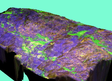
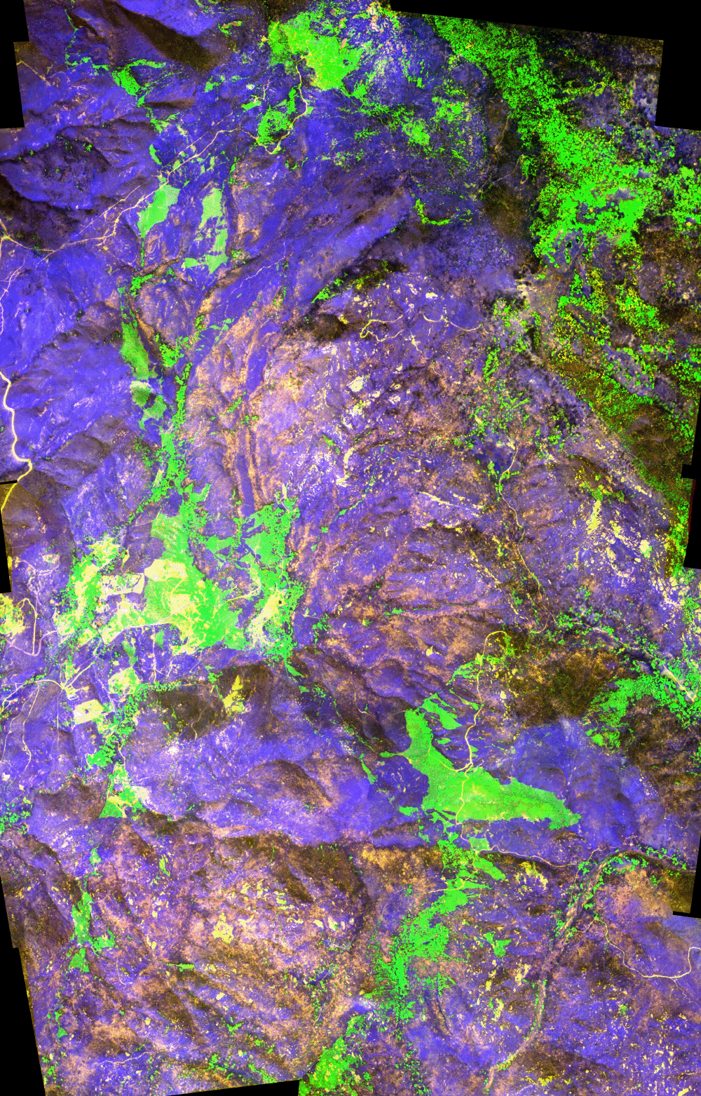
In the following false-color images healthy vegetation
appears green and recently killed conifers appear orange.
Sun-warmed rooftops
appear blue. The ash layer from the Cedar Fire is visible
in dark shades of blue and magenta.
(These RGB images depict reflected red light
at 650 nm in red, reflected near-IR
light at
850 nm in
green, and emitted thermal-IR light at
10.5 um in blue.)
|
|
|
|
Image 1:
Area west of Green Valley Falls Campground. This RGB
image was acquired at 2:33 pm, 5 November 2003.
Link
to single-page GIF
Link
to full-resolution geoTIFF (20 MB zip file) |

Click on the image above to open a new browser window,
then click to zoom in on a portion of that image.
Maximum resolution is 1.5 meters.
|
| |
|
|
Image 2:
Topographic view from the south of the area from Image
1.
Vertical exaggeration in 3-D views is 1.5 to one unless
otherwise noted. |
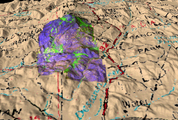
Click on the image above to view a larger JPEG image
|
|
Image 2a:
3-D interactive view of Image 2. No vertical exaggeration.
|
Click on the image above to view a VRML
model
(opens in new browser window)
(Requires a VRML plugin, such as the Cortona,
available here)
|
| |
Helpful hints for 3D viewing-
Click on the 'fit' button (lower right)
to fit the image to your browser window.
For good rotation of the 3D image, set
the 'walk' or 'fly' mode in combination with the 'plan'
movement option to move in closer (using the mouse); then
switch to the 'study' mode and the 'turn' movement option
to rotate the scene (using the mouse).
|
 Piper Navajo remote sensing aircraft

