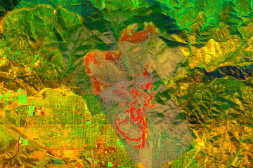
Current Image: Pass 18
Ground surface temperatures as viewed from above at 11.9 micrometers wavelength
on 25 October 2003, at 12:09 pm PDT.
Fire
Imagery
These color-coded images depict apparent ground surface temperatures
in Celsius.
The background image is a portion of a high-resolution multi-band
mosaic assembled from data collected on 9 September 2003 (pre-fire).
Do not depend
on these images for accurate fireline locations. Use the map backgrounds
as a general location guide, and look for recognizable terrain
features or landmarks on the imagery itself for relative positioning
of hotspots. Bodies of water, street grids, open fields, highways,
ridgelines and stream courses show up well in this imagery.
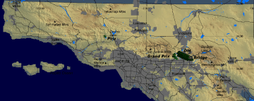
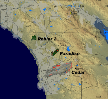
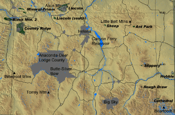
Regional
Maps
Fire locations (currently active and past) are displayed on
the map below.
Only fire incidents that have been flown as fire
research data collection missions are shown.
Click on
fire graphic or title text to open current fire imagery page for
that fire.
(Click on link below to open
larger version of map.)
FireMapper™ has
been developed through a Research Joint Venture with Space Instruments,
Inc., and support from the National Fire Plan, Forest Service International
Programs, the U.S. Department of Agriculture, the Joint Fire Sciences Program, and the U.S. Agency
for International Development.
Disclaimer: Trade names, commercial products, and enterprises
are mentioned solely for information. No endorsement by the U.S. Department
of Agriculture is implied.