|
|
|
 |
Fire Science: Wildfire Monitoring and Prediction
|
|
Fire Imaging: Esperanza Fire |
|
|
|
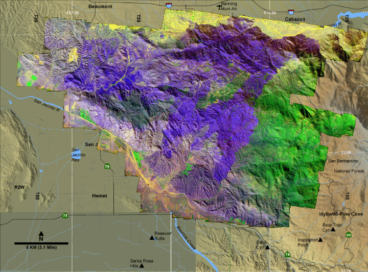
Esperanza Fire, Riverside County, CA
28 October 2006
As viewed by the FireMapper™
Thermal-Imaging Radiometer
|
|
Click on the image above to view a larger Zoomify (JPEG) image at 3 meters/pixel resolution
(opens a new browser window)
Current Image: False-color mosaic
This RGB image shows reflected red light at 650 nm in red, reflected NIR at 850 nm in green, and thermal IR at 8 - 12 um in blue as viewed from above on 28 October 2006, between 14:10 and 15:25 PDT.
|
| |
|
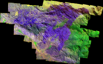
Image 1: False-color mosaic
Plan view of fire. Ash layers from recent fires are shown in shades of blue and purple.
|
Click on the image above to view a larger JPEG image
(opens a new browser window) |
|
|
|
| |
|
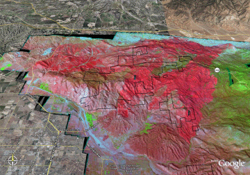
Image 2: Mosaic Overlay
Topographic view from the south. Ash layers from recent fires are shown in shades of blue and purple.
No vertical exaggeration.

View the Esperanza Fire in Google Earth.
Locations approximate.
|
Click on the image above to view a larger JPEG image
(opens a new browser window) |
|
|
|
|
| |
FireMapper™ has
been developed through a Research Joint Venture with Space Instruments,
Inc., and support from the National Fire Plan, Forest Service International
Programs, the U.S. Department of Agriculture, the Joint Fire Sciences Program, and the U.S. Agency
for International Development.
|


