|
|
|
 |
Fire Science: Wildfire Monitoring and Prediction
|
|
Fire Imaging: Sawtooth Complex & Millard Complex
|
|
|
|
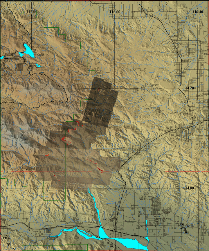
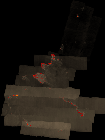
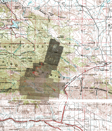
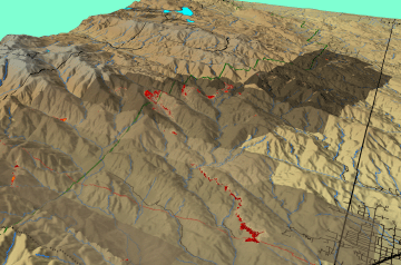
Millard Fire, San Bernardino County, CA
14 July 2006
As viewed by the FireMapper™
Thermal-Imaging Radiometer
|
|
Click on the image above to view a larger Zoomify(JPEG) image
(opens a new browser window)
Current Image: Thermal mosaic
Ground surface temperatures as viewed from above at 11.9 micrometers wavelength on 14 July 2006, between 6:05 and 7:56
|
| |
|
Image 1: Thermal Mosaic
Plan view of fire. Warmer tones represent recent or active combustion; areas of light gray are cooling ash or warm bare ground and the low temperatures of unburned forest and cool ground are shown in darker gray (see chart above). |
Click on the image above to view a larger JPEG image
(opens a new browser window) |
|
|
|
Image 2: Mosaic Overlay
Plan view of fire shown on 1:250k topo map (DRG). |
Click on the image above to view a larger JPEG image
(opens a new browser window) |
|
|
|
Image 3: Mosaic Overlay
Topographic view from southeast.
No vertical exaggeration. |
Click on the image above to view a larger JPEG image
(opens a new browser window) |
|
| |
FireMapper™ has
been developed through a Research Joint Venture with Space Instruments,
Inc., and support from the National Fire Plan, Forest Service International
Programs, the U.S. Department of Agriculture, the Joint Fire Sciences Program, and the U.S. Agency
for International Development.
|