|
|
|
 |
Fire Science: Wildfire Monitoring and Prediction
|
|
Fire Imaging |
| |
|
|
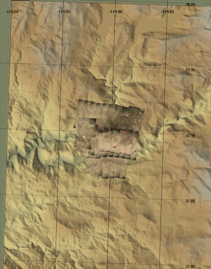
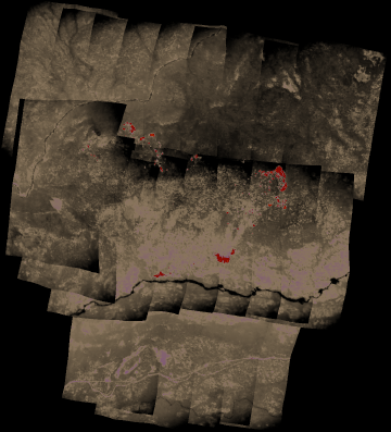
North Mountain Fire, Tuolumne County, CA
15:41 PDT 26 June 2008
As viewed by the FireMapper™ Thermal-Imaging Radiometer
|
Click on the image above to view a larger Zoomify image
or view the JPEG version
(opens a new browser window)
Ground surface temperatures as viewed from above at 8-12 micrometers wavelength on 26 June 2008, between 15:41 and 15:50 PDT.
|
| |
|
Image 1: Thermal Mosaic
Plan view of fire. Warmer tones represent recent or active combustion; areas of light gray are cooling ash or warm bare ground and the low temperatures of unburned forest and cool ground are shown in darker gray (see chart above).
Purple is used to show cooling ash but could be associated with bare ground away from fire.
|
Click on the image above to view a larger JPEG image
(opens a new browser window) |
|
|
|
Firelines
|
|
|
|
|
|
|
|
Weather conditions at time of data collection :
Portable station TS026 from NOAA ROMAN system. |
Past Weather Conditions for TS026
Observations prior to selected time: June 26, 2008 - 16:00 PDT
Weather Conditions at June 26, 2008 - 15:25 PDT
|
15:25 |
24 Hour Max |
24 Hour Min |
| Temperature |
75.0° F |
80.0 at 16:25 |
58.0 at 6:25 |
| Dew Point |
48.3° F |
52.7 at 8:25 |
43.1 at 18:25 |
| Relative Humidity |
39% |
69 at 8:25 |
30 at 16:25 |
| Wind Speed |
0 mph |
2 at 1:25 |
0 at 8:25 |
| Wind Gust |
2 mph |
4 at 16:25 |
1 at 20:25 |
| Fuel Temperature |
79.0° F |
100.0 at 13:25 |
57.0 at 4:25 |
| 10 hr Fuel Moisture |
3 gm |
5 at 4:25 |
2 at 16:25 |
| Battery voltage |
12.90 volt |
13.00 at 16:25 |
12.50 at 2:25 |
|
|
| |
FireMapper™ has
been developed through a Research Joint Venture with Space Instruments,
Inc., and support from the National Fire Plan, Forest Service International
Programs, the U.S. Department of Agriculture, the Joint Fire Sciences Program, and the U.S. Agency
for International Development.
|