|
|
|
 |
Fire Science: Wildfire Monitoring and Prediction
|
|
Fire Imaging |
|
|
|
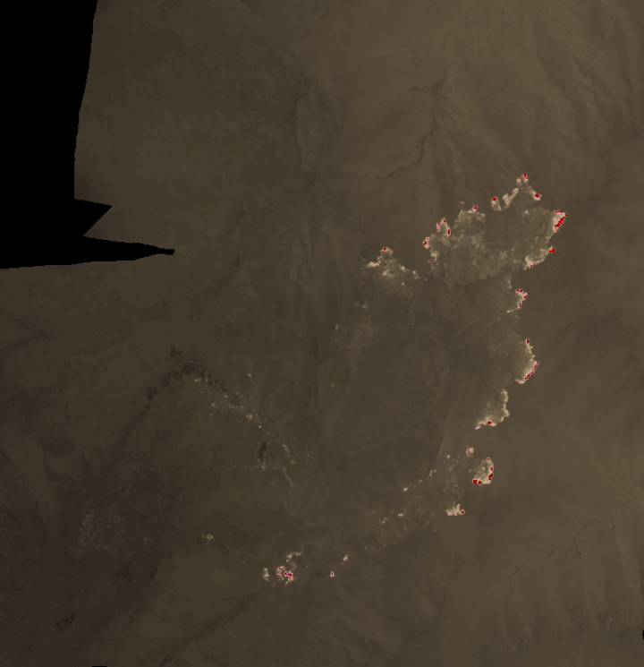
Eagle Fire, San Diego County, CA
22 July 2011 between 20:26 and 20:39 PDT
As viewed by the FireMapper™ Thermal-Imaging Radiometer
|
|
Click on the image above to view a larger JPEG version
(opens a new browser window)
Ground surface temperatures as viewed from above at 8-12 micrometers wavelength in the thermal infrared. |
| |
|
Image 1: Thermal Mosaic
Plan view of fire. Warmer tones (red, orange, yellow) represent recent or active combustion; areas of light gray are cooling ash or warm bare ground and the low temperatures of unburned forest and cool ground are shown in darker gray (see chart above). |
|
|
|
|
Firelines
Data from multiple visits may be included in this imagery. Click one of the links below to open a separate viewer with more display options.
(Zoom in to view over topographic map)
|
|
|
|
|
|
|
|
Weather conditions at time of data collection :
Ranchita station RCHC1; data from NOAA ROMAN system. |
Past Weather Conditions for Ranchita
Observations prior to selected time: July 22, 2011 - 20:07 PDT
|
|
| |
FireMapper™ has
been developed through a Research Joint Venture with Space Instruments,
Inc., and support from the National Fire Plan, Forest Service International
Programs, the U.S. Department of Agriculture, the Joint Fire Sciences Program, and the U.S. Agency
for International Development.
|


