|
|
|
 |
Fire Science: Wildfire Monitoring and Prediction
|
|
Fire Imaging: Angel Fire |
|
|
|
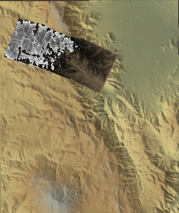
Angel Fire, San Diego County, CA
18:59 PDT 17 September 2007
As viewed by the FireMapper™ Thermal-Imaging Radiometer
|
|
Partial cloud cover (gray shades) obscures much of the area. In the unobscured area, red denotes warm pixels 18 C and above.
Click on the image above to view a larger JPEG version
(opens a new browser window)
Current Image: Thermal mosaic
Ground surface temperatures as viewed from above at 8-12 micrometers wavelength on 17 September 2007, between 18:59 and 19:01 PDT.
|
| |
|
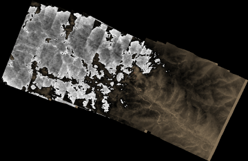
Image 1: Thermal Mosaic
Plan view of fire. Partial cloud cover (gray shades) obscures much of the area. In the unobscured area, red denotes warm pixels 18 C and above.
|
Click on the image above to view a larger JPEG image
(opens a new browser window) |
|
|
|
|
|
|
|
|
|
|
|
|
Weather conditions at time of data collection :
from NOAA ROMAN system. |
Past Weather Conditions for JULC1
Observations prior to selected time: September 17, 2007 - 20:00 PDT
Weather Conditions at September 17, 2007 - 19:14 PDT
|
19:14 |
24 Hour Max |
24 Hour Min |
| Temperature |
54.0° F |
67.0 at 14:14 |
51.0 at 23:14 |
| Dew Point |
47.3° F |
47.3 at 19:14 |
19.0 at 2:14 |
| Relative Humidity |
78% |
78 at 19:14 |
25 at 2:14 |
| Wind Speed |
9 mph from WSW |
13 at 15:14 |
5 at 23:14 |
| Wind Gust |
17 mph |
27 at 13:14 |
9 at 0:14 |
| Solar Radiation |
0.0 W/m*m |
972.0 at 12:14 |
0.0 at 20:14 |
| Fuel Temperature |
54.0° F |
80.0 at 13:14 |
47.0 at 0:14 |
| 10 hr Fuel Moisture |
9 gm |
10 at 10:14 |
7 at 20:14 |
| Battery voltage |
12.90 volt |
14.40 at 10:14 |
12.60 at 7:14 |
|
|
| |
FireMapper™ has
been developed through a Research Joint Venture with Space Instruments,
Inc., and support from the National Fire Plan, Forest Service International
Programs, the U.S. Department of Agriculture, the Joint Fire Sciences Program, and the U.S. Agency
for International Development.
|

