|
|
|
Sierra de San Pedro
Martir, Baja California Norte
17 September 2002
As viewed by the FireMapper™
Thermal-Imaging Radiometer
Images were collected from the PSW Airborne
Sciences Aircraft
|
|
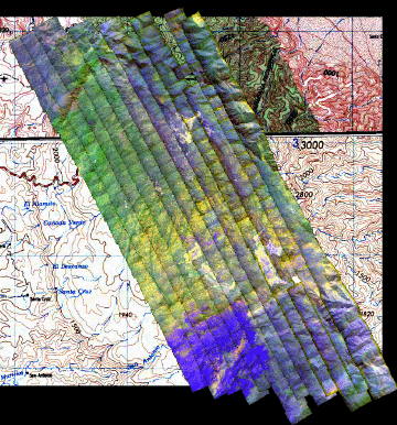
Location Map A
This image is a portion of a 1:250,000 topo map with an overlayed
mosaic.
North is at the top.
Flight path is from NW to SE.
|
Click on the image above to view a larger JPEG image
|
|
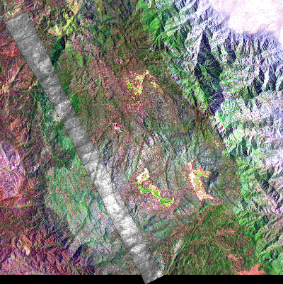
Location Map B
This image is a portion of a Landsat TM 541 image with an
overlayed grayscale mosaic of 32 images from Pass 6.
North is at the top.
Flight path is from NW to SE.
|
Click on the image above to view a larger JPEG image
|
|
|
|
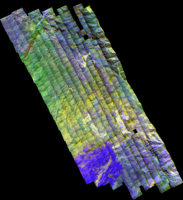
Image 1:
This mosaic of 13 transects
can be browsed at 6 meters/pixel resolution. (Original data was collected at 1.5 m/pixel.)
The va (visible red band) is shown in red; vb (near-IR band) is shown in green; ir4 (wide-band thermal IR) is shown in blue.
|
Click on the image above to view the larger Zoomify image |
| |
|
Image 2:
The va (visible red band) is shown in red; vb (near-IR band) is shown in green; ir4 (wide-band thermal IR) is shown in blue.
|
Click on the image above to view a larger JPEG image |
| |
|
|
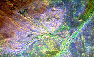
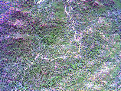
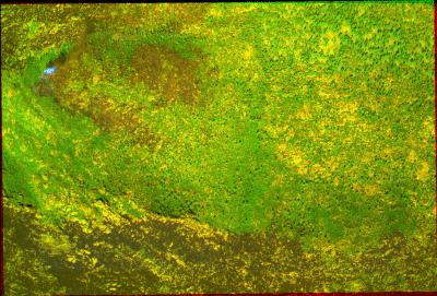
Image 3:
The va (visible red band) is shown in red; vb (near-IR band)
is shown in green; NIR ( IR) is shown in blue.
This image is from the start of Pass 6, the first transect
from the south.
Bare soil reflects in all bands, appearing white; bare rock
is magenta.
|
Click on the image above to view a larger JPEG image |
|
|
|
|
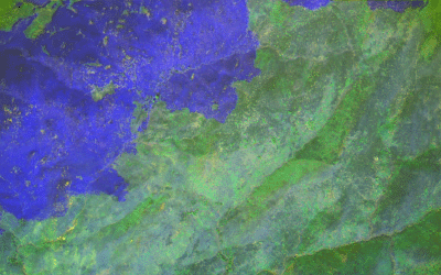
Image 4:
The va (visible red band) is shown in red; vb (near-IR band)
is shown in green; ir4 (wide-band thermal IR) is shown in
blue.
This image is from the start of Pass 11, the fourth transect
from the south.
Fresh ash layer from a recent fire absorbs solar energy,
radiating strong thermal IR (in blue).
|
Click on the image above to view a larger JPEG image |
| |
|
|
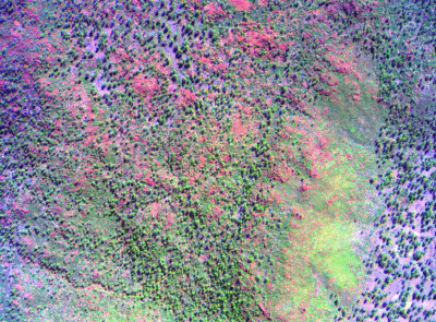
Image 5:
The va (visible red band) is shown in red; vb (near-IR band)
is shown in green; NIR ( IR) is shown in blue.
This image is from the start of Pass 19, the ninth transect
from the south.
Bare soil reflects in all bands, appearing white; bare rock
is magenta.
|
Click on the image above to view a larger JPEG image |
| |
|
|
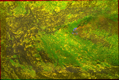
Image 6:
The va (visible red band) is shown in red; vb (near-IR band)
is shown in green; ir4 (wide-band thermal IR) is shown in
blue.
This image is from the start of Pass 10, the third transect
from the south.
Active fire is bright in the thermal IR (blue) and visible
(red) bands; smoke is red. Recently burned areas are dark
in all bands.
|
Click on the image above to view a larger JPEG image |
| |
|
|
Image 6a:
The va (visible red band) is shown in red; vb (near-IR band)
is shown in green; ir4 (wide-band thermal IR) is shown in
blue.
This image is from the end of Pass 11, the fourth transect
from the south.
Active fire is bright in the thermal IR (blue) and visible
(red) bands; smoke is red. Recently burned areas are dark
in all bands.
|
Click on the image above to view a larger JPEG image |
| |
|
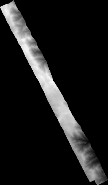
Image 7:
DTM (Digital Terrain Model) elevation map derived from our imagery. 20 meter interval; area modelled is covered by the last 2 transects on the northeast, over the most extreme relief in the area.
|
Click on the image above to view a larger JPEG image |
| |
|
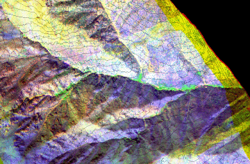
Image 8:
Full-resolution view of a portion of the next-to-last transect on the northeast with 40 meter contours from the DTM.
|
Click on the image above to view a larger JPEG image |
| |
|


