Sierra de San Pedro
Martir, Baja California Norte
9-10 September 2003
As viewed by the FireMapper™ system
in reflected red, near-InfraRed and thermal-InfraRed light
Images were collected from the PSW Airborne
Sciences Aircraft
|
|
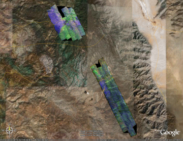
Location Map:
Shaded relief map of the southern Sierra San Pedro Martir.
North is at the top.
The colored strips show the southern portion of 3 of the
transects flown during this mission.
|
Click on the image above to view a larger JPEG image
|
|
|
|
|
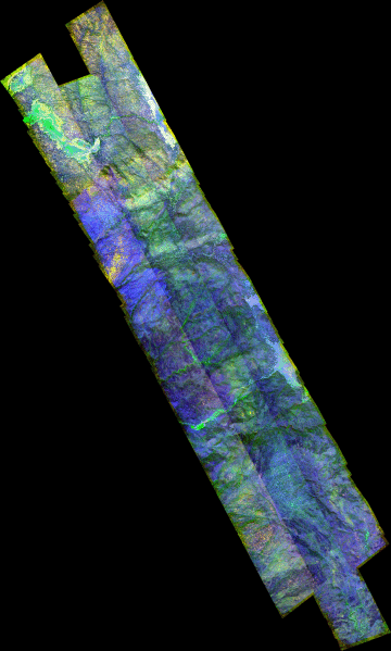
Image 1:
A mosaic of images from the transects shown above. Full-resolution image is 4 meters/pixel.

View this image of SSPM as a Google Earth overlay.
|
Click on the image above to view a larger Zoomify image |
| |
|
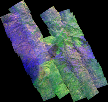
Image 2:
A mosaic of 111 images north of the area shown above. Full-resolution image is 1.5 meters/pixel.
View this image of SSPM as a Google Earth overlay.
|
Click on the image above to view a larger Zoomify image |
| |
|
Image 3:
A mosaic of 30 images from the transects shown above.
|

Click on the image above to view a larger JPEG image |
| |
|
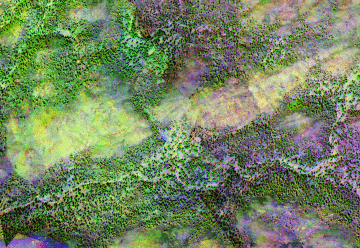
Image 4:
A closer view of the center portion of the above mosaic. Dead and dying trees are clearly visible in shades of yellow.
|
Click on the image above to view a larger JPEG image |
|
|
|
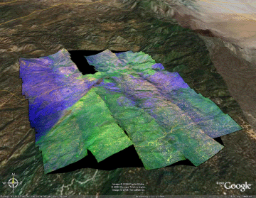
Image 5:
Perspective view from the south of the northern section.
View this image of SSPM as a Google Earth overlay.
|
Click on the image above to view the overlay in Google Earth |
|
|
|


