Troy Fire, Cleveland
National Forest
19 June 2002
(Series A, Passes 3-15)
As viewed by the FireMapper™
Thermal-Imaging Radiometer
|
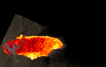
Image 1:
Ground surface temperatures as viewed from above at 11.5 to 12.3 micrometres wavelength on 19 June 2002, at 1:30 pm.

View Troy Fire image as Google Earth overlay
|
Pass 3
Click on the image above to view a larger JPEG image
(opens a new browser window)
|
|
|
|
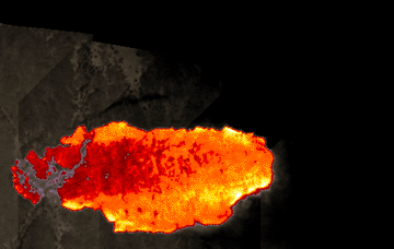
Image 2:
Ground surface
temperatures as viewed from above at 11.5 to 12.3 micrometres
wavelength on 19 June 2002, at 1:46 pm.
Note the 2 intersecting
strips of aerially delivered fire retardant north of
the fire.

View Troy Fire image as Google Earth overlay
|
Pass
5
Click on the image above to view a larger JPEG image
(opens a new browser window)
|
|
|
|
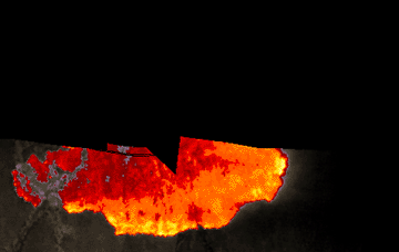
Image 3:
Ground surface temperatures as viewed from above at 11.5 to 12.3 micrometres
wavelength on 19 June 2002, at 1:51 pm.

View Troy Fire image as Google Earth overlay
|
Pass
7
Click on the image above to view a larger JPEG image
|
| |
|
|
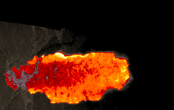
Image 4:
Ground surface temperatures as viewed from above at 11.5
to 12.3 micrometres wavelength on 19 June 2002, at 1:55
pm.

View Troy Fire image as Google Earth overlay
|
Pass
9
Click on the image above to view a larger JPEG image
(opens a new browser window)
|
|
|
|
|
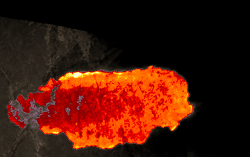
Image 5:
Ground surface temperatures as viewed from above at 11.5
to 12.3 micrometres wavelength on 19 June 2002, at 2:05
pm.

View Troy Fire image as Google Earth overlay
|
Pass
12
Click on the image above to view a larger JPEG image
(opens a new browser window)
|
| |
|
|
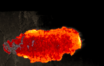
Image 6:
Ground surface temperatures as viewed from above at 11.5
to 12.3 micrometres wavelength on 19 June 2002, at 2:15
pm.

View Troy Fire image as Google Earth overlay
|
Pass
15
Click on the image above to view a larger JPEG image
(opens a new browser window)
|
| 19 June maps
19 June (series B)
19 June (series C)
19 June (series D)
| Overview
Passes 18 through 29
Passes 32 through 45
Passes 48 through 62
|