|
Note:
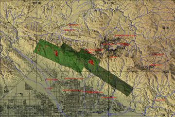
These images were collected by sensors in a small aircraft
flying in turbulent Santa Ana wind conditions, and slight
shifts and rotations between images is to be expected.
When the individual images are spliced together into a
larger mosaic, errors in edge matching may result in duplication
of some points near the seam, and the loss of others in
the overlap area.
Do not depend on these images for accurate fireline locations.
Use the map backgrounds as a general location guide, and
look for recognizable terrain features or landmarks on
the imagery itself for relative positioning of hotspots.
Bodies of water, street grids, open fields, highways, ridgelines
and stream courses show up well in this imagery.
|
 Piper Navajo remote sensing aircraft