Post-fire Mapping
Old Fire, San Bernardino NF
5 November 2003
As viewed by the FireMapper™ system
in reflected red, near-InfraRed and thermal-InfraRed light
Images were collected from the PSW Airborne Sciences Aircraft flying over the area near Lake Arrowhead.
|
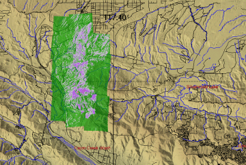
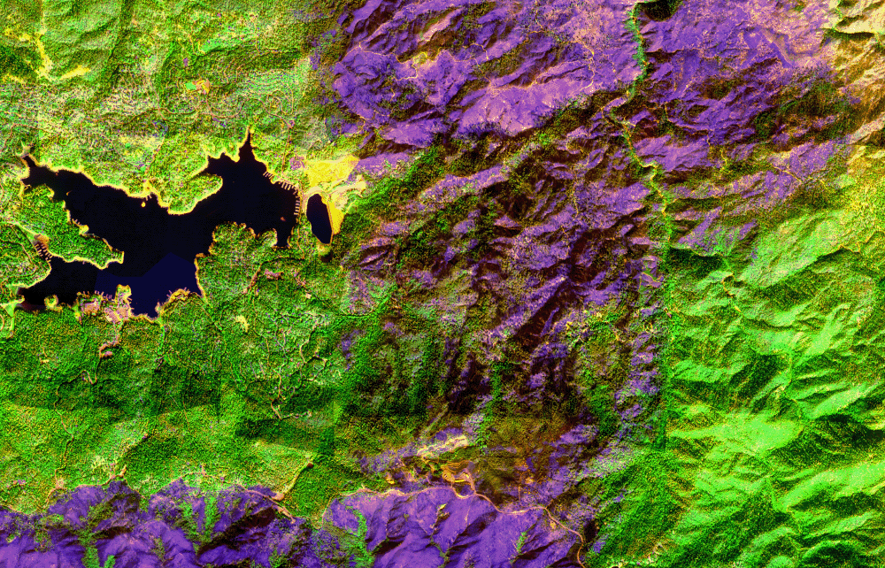
Post-Fire Imagery Area Map
|
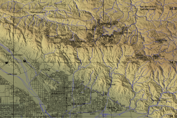
Click on the image above to view a larger JPEG image
(opens a new browser window) |
| |
|
Post-Fire Imagery Mosaic

View the false-color image in Google Earth.
|
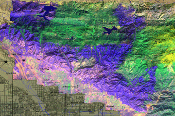
Click on the image above to view a larger JPEG image
(opens a new browser window) |
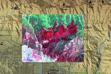
Post-fire Imagery
|
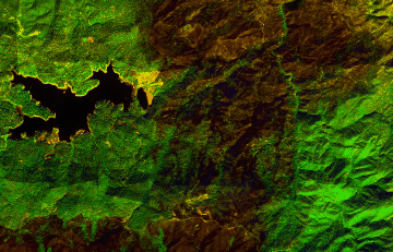
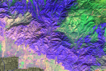
In the following false-color images healthy vegetation appears green and recently killed conifers appear orange. Sun-warmed rooftops appear blue. The ash layer from the Old Fire is visible in dark shades of blue and magenta.
(These RGB images depict reflected red light at 650 nm in red, reflected near-IR light at 850 nm in green, and emitted thermal-IR light at 10.5 um in blue.)
|
| |
|
Image 1:
Urban forest of the Cedar Glen area near Lake Arrowhead. This RGB image was acquired at 10:33 am, 5 November 2003.
Link to single-page GIF |
Click on the image above to open a new browser window, then click to zoom in on a portion of that image.
Maximum resolution is 1.5 meters.
|
| |
|
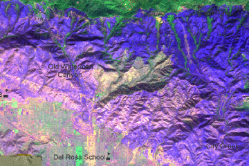
Image 2:
City Creek area below Running Springs. This RGB image was acquired at 10:33 am, 5 November 2003. |
Old Fire scar
Click on the image above to open a new browser window.
|
| |
|
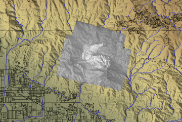
Image 2a:
Ground surface temperatures as viewed from above at 11.9 micrometers wavelength on 6 September 2003, between 16:00 and 16:12 PM PDT.
Fresh ash is the lighter gray area in the center of the image; unburned vegetation is shown in darker shades of gray. |
Bridge Fire scar
Click on the image above to open a new browser window.
|
| |
|
Image 3:
Ground surface temperatures |
Blue Cut Fire scar
Click on the image above to open a new browser window.
|
| |
|
Image 3a:
|
Blue Cut Fire scar

Click on the image above to open a new browser window.
|
| |
|
Image 4:
Arrowhead Springs area below Rimforest. This RGB image was acquired at 10:33 am, 5 November 2003. |
Old Fire scar
Click on the image above to open a new browser window.
|
| |
|
Image 4a:
Landsat image from 2002 shows the ash layer from the June 1 to 7 Arrowhead Fire. |
Arrowhead Fire scar
Click on the image above to open a new browser window.
|
 Piper Navajo remote sensing aircraft


