|
|
|
Pre- and post-fire
comparison,
San Bernardino Del Rosa neighborhood
19 September and 5 November 2003
As viewed by the FireMapper™
system
in reflected red, near-IR, and thermal IR frequencies
Images were collected
from the PSW Airborne Sciences Aircraft flying over
San Bernardino.
|
|
|
There is great interest in defining the factors that determine whether a structure survives when wildfire moves into an urban area. Examine the two images of the Del Rosa neighborhood of San Bernardino below, one collected before the Old Fire, and one collected after. Burned shrubbery and scorched lawns surround empty foundations where houses once stood.
|
| |
|
|
Location Map:
Shaded relief map of the North San Bernardino, Hamilton
Mountain and Keller Peak area. Color overlays show area of processed
imagery.
|
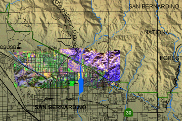
Click on the image above to view a larger JPEG image in a new browser
window
|
| |
|
|
Image 1:
Mosaic of images from flight 19 September, 2003
|
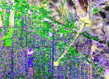
Click on the image above to view a larger JPEG image in a new browser
window at full resolution
|
Open both images to directly compare property loss due to fire. |
|
Image 2:
Mosaic of images from flight 5 November, 2003 |
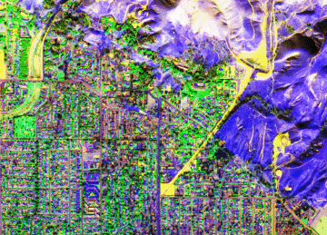
Click on the image above to view a larger JPEG image in a new browser window at full resolution
|
| |
Healthy vegetation is bright green; stressed or dying vegetation is yellow-brown in this false-color depiction.
(This RGB image shows reflected red light at 650 nm in red, reflected NIR at 850 nm in green, and thermal IR at 10.5 um in blue.) |
 Piper Navajo remote sensing aircraft